Mynydd Llangorse

Trig Point · TP5020

About Mynydd Llangorse

ReferenceTP5020
Grid referenceSO157261
Height in metres506 metres
Height in feet1662 feet
Latitude51.9270838
Longitude-3.227099631
CountryWales
Pillar typePillar
ConditionGood
Historic use3rd order
Current usenone
Trigpointing UKView record

Best time to visit Mynydd Llangorse

Best months to visit: May, Jul, Aug

These months tend to be warmer and drier than the rest of the year.

Hottest months: Jun, Jul, Aug

Coldest months: Jan, Feb, Mar

Rainiest months: Jan, Oct, Dec

JanFebMarAprMayJunJulAugSepOctNovDec
Day temperature5 °C7 °C9 °C11 °C15 °C18 °C19 °C18 °C16 °C13 °C9 °C7 °C
Night temperature0 °C2 °C2 °C3 °C7 °C10 °C11 °C11 °C9 °C8 °C4 °C3 °C
Rain133 mm119 mm94 mm78 mm70 mm75 mm61 mm59 mm112 mm134 mm123 mm147 mm

Based on Allt yr Esgair, 3.6 km away. Historical seasonal averages. Weather data by Open-Meteo.

Walk videos

Route notes, timings, and viewpoints from walking videos.

Bwlch to Llangorse Mountain- A Classic Brecon Beacons Walk

Brecon Beacons Walking

5 notesfrom YouTube

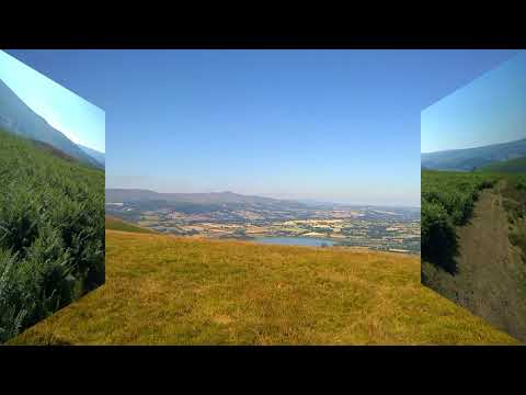
Mynydd Llangorse, also known as Llangorse Mountain, sits in the Black Mountains at the eastern edge of the Brecon Beacons National Park. The standard walk starts from the village of Bwlch and follows a ridge to the summit, with views over Llangorse Lake, the central Beacons, and the Black Mountains.

Show 5 notes
  • Summary

    Mynydd Llangorse, also known as Llangorse Mountain, sits in the Black Mountains at the eastern edge of the Brecon Beacons National Park. The standard walk starts from the village of Bwlch and follows a ridge to the summit, with views over Llangorse Lake, the central Beacons, and the Black Mountains.

    This is a classic Brecon Beacons walk, this one, from Bwlch up to Llangorse Mountain
    Watch on YouTube
  • Route

    The standard start is the village of Bwlch, on the A470 between Brecon and Crickhowell. The walk starts along the road then climbs to the ridge line and heads north along the summit.

    I'm in Brecon today, which is in the central Brecon Beacons and the sort of edge of the Black Mountains. That's the New Inn, the pub
    Watch at 0:03
  • Observation

    The summit has views over the Black Mountains (Fan Gyhirych, Tor y Foel), the central Beacons, Allt yr Esgair, and down to Llangorse Lake.

    Black Mountains, Fan Gyhirych, uh Tor y Foel, the central Beacons, and Allt yr Esgair. And uh Llangorse Lake as well.
    Watch at 7:25
  • Route

    From Bwlch the walk follows the ridge north to the summit. A longer option continues along the ridge to Cockett Hill and on to Fan y Big for a much bigger day.

    You can do a longer stretch as well, if you're feeling very fit, where you go down to Cockett Hill, and then you go up onto um you go up onto Fan y Big
    Watch at 8:07
  • Observation

    The Bwlch-to-summit-and-back walk takes around 3 hours. The longer route to Fan y Big is described as "a big walk."

    this was about 3 hours, it's a nice
    Watch at 8:30

Mynydd Llangorse (Llangorse Mountain) Walk

Brecon Beacons walking

2 notesfrom YouTube

An alternative start is the Llangorse activity centre on the edge of Llangorse Lake. The walk from here is a steep direct climb up the south face of the mountain rather than the longer ridge approach.

Show 2 notes
  • Route

    An alternative start is the Llangorse activity centre on the edge of Llangorse Lake. The walk from here is a steep direct climb up the south face of the mountain rather than the longer ridge approach.

    we're at plan course activity center we were going to walk around flag or snake today but due to extensive flooding that's no longer a possibility so our alternative plan is to go up plan Wars mountain
    Watch at 0:05
  • Route

    The direct climb from the Llangorse activity centre is described as "pretty steep pretty steep climb" — not gradual, but straight up the face. Rewards come quickly in the form of views over Llangorse Lake.

    it's pretty steep pretty steep climb it's not we're not doing sort of a gradual thing it's pretty much straight the way up
    Watch at 0:43

Llangorse Mountain Circular Walk 8th July 2018

Brecon Beacons Walking

4 notesfrom YouTube

The summit area is a Site of Special Scientific Interest. Walkers should stick to the paths and not disturb the protected ground.

Show 4 notes
  • Observation

    The summit area is a Site of Special Scientific Interest. Walkers should stick to the paths and not disturb the protected ground.

    this is like this Special Scientific Interest
    Watch at 2:20
  • Observation

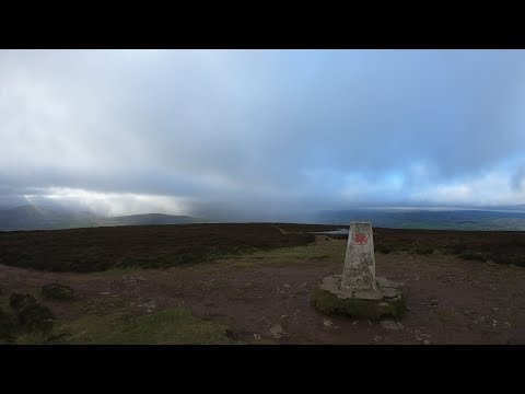
    The trig point sits on the flat summit of Mynydd Llangorse. It is visible from below as a small concrete pillar against the sky.

    there's a Passover a trick point there's a tiny bit of cloud hanging my let's try it
    Watch at 3:05
  • Safety

    In midsummer the ridge can be hot and exposed. Walkers should carry plenty of water — the walker in this video turned back short of the trig because he didn't have enough.

    it's a decidedly hot and sweaty day you know you can see the sweat limping on my arm I am smoking it's gotta be mid twenties now
    Watch at 3:20
  • Safety

    The approach and surrounding moorland can be boggy, especially after rain. Walkers should expect wet sections of path and plan accordingly.

    there's certainly not a fair bit of water so far getting up there and now he's down them back up to the trick point water in suspicion
    Watch at 4:23

Gallery

Photo: Chris Andrews . Licensed CC BY-SA 2.0. Source: Wikimedia.
Photo: Trevor Littlewood . Licensed CC BY-SA 2.0. Source: Wikimedia.
Photo: Gareth James . Licensed CC BY-SA 2.0. Source: Wikimedia.
Photo: Iain Macaulay. Licensed CC BY-SA 2.0. Source: Wikimedia.
Photo: Shaun Ferguson . Licensed CC BY-SA 2.0. Source: Wikimedia.

Map

Classifications