Snowdon Summit

Trig Point · TP6043

The trig point on the summit of Snowdon, Yr Wyddfa in Welsh, sits
at 1,085 metres above sea level, the highest point in Wales and the
highest in the British Isles south of the Scottish Highlands. It is
the goal of more than half a million walkers a year, which makes
Snowdon the busiest mountain in the UK and the summit the most
crowded trig point in the country on a sunny weekend.

The Llanberis Path from the village of Llanberis is the easiest and
busiest route, a long, shallow climb of about 14.5 kilometres there
and back, mostly on rough stone and gravel with a short tarmac start
for the steepest first section. A rack railway has run up the same
line since 1896 and carries most of the non-walking traffic. The
Snowdon Ranger Path from Llyn Cwellyn is the second easiest,
quieter for those who want their own space. Walkers with a head for
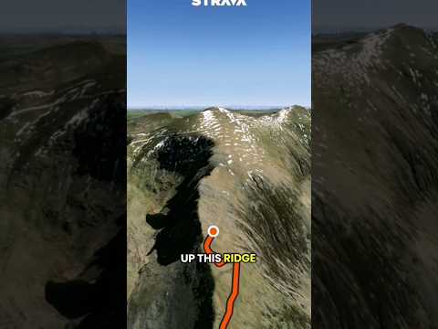
heights can come up Crib Goch or the Snowdon Horseshoe, both proper
scrambles along the knife-edge ridges on the east side of the
mountain. Allow eight hours for the Llanberis round trip if you
stop for lunch. Winter adds an extra hazard, a short section just
above the railway station known as the Killer Convex that has cost
lives in icy conditions.

About Snowdon Summit

ReferenceTP6043
Grid referenceSH609543
Height in metres1086 metres
Height in feet3562 feet
Latitude53.06847265
Longitude-4.076223557
CountryWales
Pillar typePillar
ConditionGood
Historic use3rd order
Current usenone
Mountain Snowdon - Yr Wyddfa
Trigpointing UKView record

Best time to visit Snowdon Summit

Best months to visit: May, Jul, Aug

These months tend to be warmer and drier than the rest of the year.

Hottest months: Jun, Jul, Aug

Coldest months: Jan, Feb, Mar

Rainiest month: Dec

JanFebMarAprMayJunJulAugSepOctNovDec
Day temperature1 °C2 °C4 °C6 °C10 °C12 °C13 °C12 °C11 °C7 °C4 °C2 °C
Night temperature-4 °C-2 °C-2 °C-1 °C3 °C5 °C6 °C7 °C5 °C3 °C0 °C-2 °C
Rain225 mm210 mm194 mm145 mm126 mm181 mm142 mm174 mm209 mm264 mm237 mm316 mm

Based on Snowdon - Yr Wyddfa, 0.0 km away. Historical seasonal averages. Weather data by Open-Meteo.

Walk videos

Route notes, timings, and viewpoints from walking videos.

Hiking to Snowdon Summit via The Ranger Path

Quality Mountain Day

1 notefrom YouTube

The Ranger Path starts at the Snowdon Ranger car park by Llyn Cwellyn reservoir and is one of two paths ascending the western slopes of the Snowdon massif. It is considered one of the easiest paths on Snowdon, with far less footfall than the Llanberis Path or Pyg Track. The route is about 8 miles round trip, takes 5 to 7 hours, and involves no scrambling, climbing a ridge line that is mainly gravel, loose stones and rocky sections before meeting the Llanberis Path and Pyg Track and continuing to the summit.

Show 1 note
  • Route

    The Ranger Path starts at the Snowdon Ranger car park by Llyn Cwellyn reservoir and is one of two paths ascending the western slopes of the Snowdon massif. It is considered one of the easiest paths on Snowdon, with far less footfall than the Llanberis Path or Pyg Track. The route is about 8 miles round trip, takes 5 to 7 hours, and involves no scrambling, climbing a ridge line that is mainly gravel, loose stones and rocky sections before meeting the Llanberis Path and Pyg Track and continuing to the summit.

    There's much less footfall coming this way than there is hiking up the Llanberis Path or the Pyg Track.
    Watch on YouTube

Snowdon: Easiest to Hardest Routes Ranked

The Bald Scrambler

8 notesfrom YouTube

The Llanberis Path is described as by far the easiest route up Snowdon, and also the longest and shallowest. It is the most popular route and is nearly always busy on any day with a chance of sunshine, which makes it a good choice for walkers worried about getting lost.

Show 8 notes
  • Route

    The Llanberis Path is described as by far the easiest route up Snowdon, and also the longest and shallowest. It is the most popular route and is nearly always busy on any day with a chance of sunshine, which makes it a good choice for walkers worried about getting lost.

    this is by far the easiest route up Snowdon it's also the longest route but it is the shallowest as well
    Watch at 0:17
  • Summary

    The presenter ranks the main routes up Snowdon from easiest to hardest: the Llanberis Path, the Snowdon Ranger Path, the Pyg and Miners' Tracks, the Rhyd Ddu path and the Watkin Path are walking routes, while Crib Goch and the Snowdon Horseshoe are scrambling routes.

    Watch at 0:17
  • Route

    The Snowdon Ranger Path is rated the second easiest route up Snowdon, just a little more rugged in a couple of sections. A loop is possible by going up the Llanberis Path and down the Ranger Path, rejoining the town of Llanberis via a footpath.

    you could go up the Llanberis Path, go down the Snowdon Ranger Path, and link back into the town of Llanberis on a footpath
    Watch at 1:30
  • Route

    The Pyg Track and Miners' Track form a circular route that starts at Pen-y-Pass car park. The car park sits about a third of the way up the mountain, making both routes shorter than the Llanberis and Ranger paths, though steeper. Most people go up the Pyg Track and down the Miners' Track, and the two are broadly similar in difficulty, with the Pyg Track slightly more rugged.

    the car park is actually about a third of the way up the mountain
    Watch at 2:30
  • Observation

    The Rhyd Ddu path is described as the presenter's favourite because it is the quietest route on Snowdon: he saw only four or five people all day and had the summit to himself. The route runs near the top of a cliff, so it may not be the best choice on a windy day, and it is a little more rugged and harder to follow than the easier tourist paths.

    I think I only saw four or five people all day
    Watch at 3:34
  • Route

    The Watkin Path is one of the longer routes up Snowdon. It starts through an ancient forest, passes waterfalls and pools of water and then some old derelict buildings before the main path. The final section is very rugged with lots of loose scree and has turned people back; the park authority has recently paved roughly the final 100 metres to make it easier.

    the sort of final 100 metres or so they've actually paved it
    Watch at 4:27
  • Safety

    Crib Goch is a full-on scrambling route along a knife-edged ridge that cannot be completed using only your feet, making it effectively a climbing route. It needs a good head for heights and is best left for calm days with good visibility. The presenter calls it one of his favourite scrambles in the UK and a memorable way onto the summit of Snowdon.

    you cannot complete this route by only using your feet
    Watch at 5:41
  • Safety

    The Snowdon Horseshoe is rated the most difficult route on the mountain because it combines Crib Goch with a further grade-one scramble on the other side, reached via the Watkin Path. It is not for the faint-hearted and is best attempted when the weather is on your side.

    it's essentially Crib Goch plus another grade one scramble on top of that one as well
    Watch at 6:33

How Difficult is the Llanberis Path up Snowdon?

The Bald Scrambler

10 notesfrom YouTube

The first few hundred metres of the Llanberis Path are the steepest of the route but are tarmac, after which the path becomes rocky and gravelly. The path is rugged and uneven with loose stones and rocks, but most able-bodied walkers should manage, and it is fairly shallow compared with other routes. The route is clearly not suitable for wheelchairs or buggies.

Show 10 notes
  • Route

    The first few hundred metres of the Llanberis Path are the steepest of the route but are tarmac, after which the path becomes rocky and gravelly. The path is rugged and uneven with loose stones and rocks, but most able-bodied walkers should manage, and it is fairly shallow compared with other routes. The route is clearly not suitable for wheelchairs or buggies.

    the first few hundred metres of this route are the steepest but thankfully are made from tarmac
    Watch at 0:29
  • Observation

    The lower half of the path rises gradually through a valley with grassy hills on either side and is not as scenic, rocky or dramatic as routes on the other side of Snowdon, though the views do get better as height is gained. The route runs roughly parallel to the mountain railway and the two cross each other a couple of times.

    this route isn't as scenic rocky or dramatic as some of the other routes on the other side of Snowdon
    Watch at 1:20
  • Route

    One-way train tickets down the mountain are only available on a first come, first served basis, so without a booked round trip a walker will almost certainly not get down by train unless they are very lucky.

    one-way tickets are only available on a first come first served basis
    Watch at 1:42
  • Route

    Just beyond the halfway house the path reaches Clogwyn station, just over halfway to the summit. The path here steepens and is notably looser underfoot. On the presenter's trip the visibility from there to the summit was poor, just 20 to 40 metres in places. The path continues alongside the railway until it is joined by paths from Rhyd Ddu, the Pyg Track and the Snowdon Ranger Path.

    this is also where the clouds were during my trip
    Watch at 1:57
  • Summary

    A round trip up and down the Llanberis Path is around 14.5 km, about 9 miles. The average person takes around 5 1/2 to 7 hours, and the presenter suggests allowing 8 hours to include lunch and stopping for photos.

    about 9 miles
    Watch at 2:35
  • Observation

    The Llanberis Path sees plenty of dog walkers, guided walks and school groups and is the most forgiving of all the routes, but it is still hard-going, rugged and tiring on the legs, especially in direct sunlight, and can be unnerving in fog with low visibility.

    it's still hard-going rugged tiring on the legs
    Watch at 2:52
  • Route

    From the summit the options are going back down the way you came, which is the easiest and most popular, going down the Pyg Track and catching a bus back to Llanberis town, or going down the Snowdon Ranger Path and taking its connecting path back to Llanberis.

    Watch at 4:01
  • Safety

    The section of the Llanberis Path just after Clogwyn station, known as the Killer Convex, is notoriously dangerous in winter. When covered in ice and compacted snow it is extremely slippery, and without crampons, an ice axe, and the knowledge to use them there is a real chance of sliding off the side of the mountain. The presenter reports that a few years ago two men died there after sliding over the top of a cliff. It is not an issue in summer, but the path is best avoided in winter without winter kit.

    a few years ago two men actually perished here as they slid off of the side of the mountain and over the top of a cliff
    Watch at 4:26
  • Observation

    On his June trip low cloud capped the summit, making the views a let-down, though it cleared below the cloud around the halfway house and Clogwyn station area on the descent.

    with the low cloud the views are a bit of a let down today
    Watch at 5:26
  • Safety

    Even on a June day, three separate people asked the presenter whether they were on the correct path, showing how easy it is to get lost, especially in cloud. He recommends checking the weather forecast before setting out, because even light cloud can be enough to disorientate you.

    even if it looks like it's only light cloud that can still be enough to disorientate you
    Watch at 5:54

How to hike SNOWDON for beginners via The Llanberis Path (the easiest route)

George Soan

10 notesfrom YouTube

For a first climb the video follows the Llanberis Path, the easiest route according to AllTrails and the Snowdon website. It is still a strenuous climb of about 14 km there and back, and a train also runs up the mountain as an alternative. There are six different routes up Snowdon, some of which need pre-planning, so the video recommends doing research before picking a route.

Show 10 notes
  • Summary

    For a first climb the video follows the Llanberis Path, the easiest route according to AllTrails and the Snowdon website. It is still a strenuous climb of about 14 km there and back, and a train also runs up the mountain as an alternative. There are six different routes up Snowdon, some of which need pre-planning, so the video recommends doing research before picking a route.

    it's 14 kilometers there and back
    Watch at 0:40
  • Route

    The Llanberis Path is convenient because there is parking at the base of Snowdon costing £11 for the day with secure parking, and the walk starts straight from the car park.

    there's 11 pounds for the day but your car is securely parked
    Watch at 1:19
  • Observation

    A cafe about three kilometres up the path sells freshly made rolls, and the walkers stopped there rather than joining the long queue at the bottom cafe.

    there's a cafe about three kilometers up
    Watch at 2:10
  • Observation

    On their climb the last quarter of the walk up to the summit was especially windy, and they had heard the wind is even worse where the other tracks come up the other side of the mountain.

    the last quarter of the walk was especially windy
    Watch at 4:52
  • Observation

    Facilities on the Llanberis route are good: easy parking, a cafe and toilets at the bottom. Those bottom toilets were the only ones on the whole hike, with nothing up the mountain, not even at the halfway cafe or the summit, so walkers should plan accordingly.

    that was the only toilet that we saw on the whole hike
    Watch at 5:20
  • Other

    The video recommends bringing your own food rather than relying on the cafes, which can be closed. The couple carried a ready-made pasta meal, a banana, a protein bar, sweets and chocolate, plus about a litre and a half of water, of which they only used about half a litre.

    we had about a litre and a half of water
    Watch at 5:43
  • Safety

    Even in the middle of summer the summit was really windy and cold, so the pair wore a base layer, a puffer jacket and a rain jacket. The presenter came away wind-burnt and recommends a buff and a beanie or hat to keep the head and ears warm.

    bring a buff if you have one for those really really windy days
    Watch at 6:30
  • Other

    The couple wore Gore-Tex North Face hiking shoes that were essentially waterproof. Many people do the walk in trainers, and it is doable, but there is the potential to slide around, and jeans are not recommended because wet jeans make for an unpleasant day.

    there is the potential to slide around if you're wearing trainers
    Watch at 7:05
  • Other

    Hiking poles are not a necessity on the way up, but the presenter says his knee really could have used at least one pole on the descent, so they may help anyone with bad knees or ankles.

    on the way down my knee really could have used at least one hiking pole
    Watch at 7:50
  • Safety

    The route is fairly straightforward, but there are one or two turnings that could be taken wrongly on the way back down, so downloading an offline map or carrying a physical map gives peace of mind.

    there are one or two turnings you could potentially take the wrong turning off on the way back down
    Watch at 8:23

Gallery

Map

Classifications