What is a trig point?
A trig point (short for triangulation pillar) is a short concrete pillar that the Ordnance Survey installed on hilltops and high ground across Great Britain. About 6,500 of them were built between 1936 and 1962 during the retriangulation of Great Britain, the project that produced the OS map grid still printed on every Ordnance Survey map today.
Each pillar gave a survey team a solid base to set up a theodolite, an instrument for measuring horizontal angles very precisely. From one pillar the team could see at least two others on a clear day. They measured the angles between those pillars, did the same from the other end, and used the geometry of triangles to fix the exact position of every pillar on the new national grid. The white concrete design used on most pillars was drawn up by Brigadier Martin Hotine, who led the retriangulation.
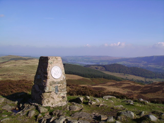
Trig points are no longer needed for mapping. Surveyors now use satellites and the OS Net network of global navigation receivers, and Ordnance Survey states that the old pillars are obsolete in their original role. Around 6,000 are thought to still be standing. Walkers and a small community of trigbaggers still seek them out, because a trig pillar usually marks the highest point of a hill, makes a clear target for a short walk, and carries a small brass flush bracket that records its number on the OS record.
On this site every trig pillar on the British and Irish hills in the directory has its own page with its grid reference, height, condition, and the Ordnance Survey and Trigpointing UK records that go with it. The full list of more than 14,000 trig points is on the trig points index.
Find a trig point near you
Browse the full trig points directory to search by country or classification, or pick a well-known hill and read the trig page linked from its mountain record.